| |
|
|
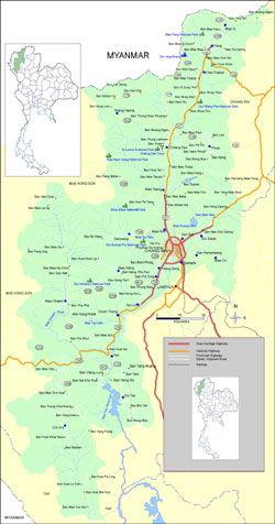
CHIANG MAI
|
Map of Chiang
Mai |
|
 |
| |
| Chiang Mai city is
700 kilometres north of Bangkok, was founded in 1296,
and is located in a fertile valley some 300 metres above
sea level. Chiang Mai is Thailand's second largest city.
This statistic, often bandied about, has always testified
to the enormity of Bangkok rather than the size of Chiang
Mai, but things are changing. |
| |
|
| |
| The
northern capital still captures the feel of a small town,
but most first-time visitors are surprised at how cosmopolitan
it is. |
| |
| Allow
a day or two to wander around the city, see its temples,
and experience the exten-sive Night
Bazaar, which offers Thai and northern Thai clothes
and fabrics, crafts, jewellery, antiques and the like.
|
| |
| At
Warorot market, one can find
even more bargains. There are also many shopping destinations
just outside the town specialising in such items as umbrellas,
silverwork, woven baskets, woodcarvings, and antiques. |
| |
|
|
20,000 square
kilometres |
|
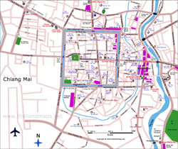
|
Chiang Mai City
Map |
|
|
| The
case with which one can leave Chiang Mai, traffic not withstanding,
reflects its smalltown atmosphere. A 15-minute ride in any direction
from Tha Phae gate at the city centre will lead you into the countryside.
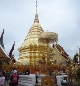
One of the most obvious trips is to the 1676-metre-high mountain known
as Doi Suthep,
which fills the western sky. |
| |
| |
| |
| |
Attractions |
|
| |
|
|
|
|